Mykonos Maps
Visit our new map of Mykonos beaches
Mykonos Island
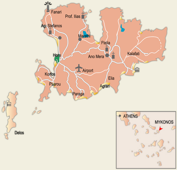
Mykonos is located southeast of Tinos island, Its area is 88sq km and the total length of its coasts is 81.5 km. It is a granite mass rising out of the waters of the Aegean, treeless island. But with a very good climate.
Its coastline forms many bays: Panormos bay with the little islet of Marmaronisi to the noth, Merthuas bay to the east, the bays of Kalo Livadi and Ornos on the south coasts, and Korfos bay to the west, on which the picturesque port of Mykonos (Hora) is located.
Its highest hill is profitis Ilias Vorniotis (375m) in the northwest. In the approximate centre of the island rises Kounoupas (275m), while to the east is the hill of Profitis Ilias Anomeritis (351m).
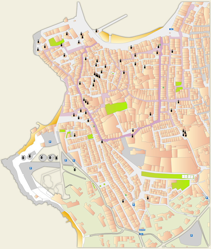
Mykonos Town (Hora)
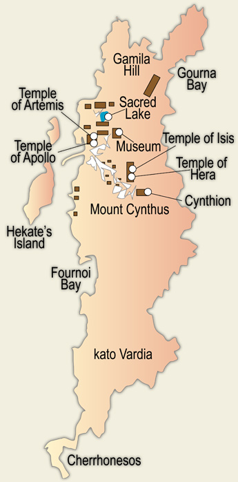
Map of Delos
Delos is 3.5km southwest of Mykonos. It has an area of 6.85 sq. km, its coasts have a total length of 8 km and administratively, it belongs to Mykonos. Its highest point is Kynthos hill at 112.6m. The length of the island from north to south is no more that 5km, and its maximum width is 1.3km.
Delos and its neighboring island of Rheina are known as the Deles. Rheina, with an area of 14 sq. km, is called Megali Delos (Large Delos), while Delos is called Mirki Delos (Small Delos). Rheina is inhabited in contrast to Delos. Delos is one of the most important archeological sites of Greece and is also considered by UNESCO as a World Heritage.